Hossa National Park
Level (* * ) two bears
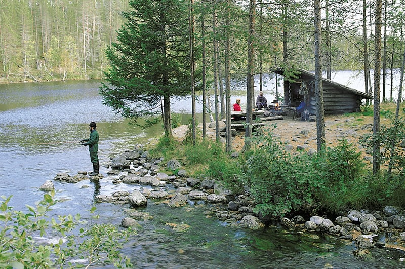
Hossa is one of the state’s hiking areas. It’s a great destination for hiking, skiing, canoeing and fishing. The forests are mainly easy and pretty pine forests, even heaths and magnificent ridges, left by the Ice Age.
There are trees of many ages, old too, and there’s evidence of old logging sites. Only one tenth of Hossa is swamp. There are over 130 lakes and ponds in the area.
Especially noteworthy ridges include Huosiharju, with grand old pines, and the narrow Hoiluansärkkä, surrounded by lakes.
Hossa is mainly dedicated for camping and hiking, and commercial forestry is allowed in a limited scale. In the primaeval forests of Huosiharju and Somerjärvi, logging is not allowed.
Many of the lakes in Hossa are chained together, which makes them perfect for canoeing. You can read more in the section about canoeing routes.
The Park has many round-trip trails. Close to the Visitor Centre, there’s a 3km nature trail, going round Huosilampi pond and a small kettle hole.
Many marked trails meet in Huosivirta, where there’s a parking area, about 3km west of the Visitor Centre. Starting from here, the round-trip trails include a trail, marked in yellow and going round lake Huosiusjärvi for 7.5km. Marked in blue, there’s the 13.5km Somerjoki route, running on the south-western shores of the many lakes to lake Laukkujärvi and returning back on the north-eastern side, and a red trail running 20km in the middle of the area near lakes Valkeaiset, Pitkä-Hoilua and Lounaja.
Other round-trip trails are the Värikallio trail and Ölkyn ähkäisy, starting from the Lihapyörre parking area.
The Värikallio trail passes the Somerjoki banks to Ala-Ölkky and Värikallio, the site of one of the largest rock paintings in Finland. The 8-km-long trail returns via pine forests.
The Värikallio trail has a connecting trail to the south end of Julma-Ölkky, where there’s a summer café. From there, you can choose to hike the 10km long Ölkyn ähkäisy trail, marked in orange around the ravine lake.
All the above routes have many resting spots, and many of the round-trip trails have connecting paths to other routes. The trails are clear and well-marked, but as the network is dense, you may find the trail map of Hossa-Martinselkonen a great help.
Further info:
Jouni Laaksonen (ed.): Kainuun luontokohdeopas, Edita 2005.
Driving instructions:
Hossa National Park and the Visitor Centre are right off Via Karelia (843). Via Karelia has good signs.
Hossa Visitor Centre


