Iso-Palonen – Maariansärkät Nature Reserve
Level: (* * ) Two bears
The Iso-Palonen – Maariansärkät Nature Reserve is one of the five nature reserves of the Friendship Park in Kuhmo.
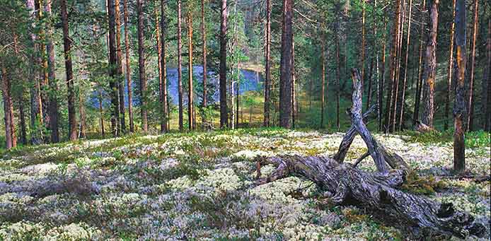
Situated in eastern Kuhmo, the area is characterized by small lakes, many ponds, pine forests and ridges, formed by the Ice Age, or “särkkä”, as they’re called in Kainuu. The nature reserve meets the Russian border in the east. The ridges running through the area have been an important migration route and grazing area for wild forest reindeer. Remnants of early hunting culture can still be seen.
The finest ridges are Jäkäläsärkkä, west of Lake Iso-Palonen, and Maariansärkkä ridges in the east. Lakes Iso-Palonen and Veräinen are the largest lakes in the area. Smaller lakes and ponds can be found in abundance.
The forests are relatively young, because the pine forests have been felled for tar and timber. Loggings were frequent until the 1960’s, when the nature reserve was established. Beautiful pine heaths are now left to grow in their own pace. Narrow patches of marsh and lush banks of streams are an exception to otherwise quite meagre vegetation. All four of our top predators and wild forest reindeer are met here.
The hiking trails are mainly on the western side of the area. Starting from the parking area in Valkeiskangas, the round-trip trail, “Pikku-Palosen kierros” is 4.8 km long, travelling round the Lake Pikku Palonen and making a detour to Lake Veräinen, to a campfire site in Määtänniemi. North of the Papinsalmi bridge between Iso Palonen and Pikku-Palonen, on the eastern side of the trail, you can see an old tar-burning pit, and on the southern side, remnants of WWII trenches.
You can start the round-trip trail “Iso-Palosen kierros” either from the Valkeiskangas or Matokangas parking area. Starting from the former, the route is 14km, and from the latter, 12km. There are three lean-tos and campfire sites by the trails, as well as old hunting pits and rock piles called “lapinhauta”.
In the western end of the round-trip trail “Iso-Palosen kierros”, you can find another trail, Jäkäläsärkän polku, where the forests are distinctly in their natural state. The steep ridge grows both spruces and pines. On the 3.6km trail, you can see great pines with “palokoro” marks – evidence of old forest fires – the Olkonniemi lean-to, a tar-burning pit and remnants of a forest sauna.
The campfire sites in the area have benches and tables, and are roofed for convenience.
The UKK trail in Kuhmo shares the same trail with the “Iso-Palosen kierros”. Coming from the south, it runs through the Maariansärkät ridge area. In the west, the UKK trail continues to Lentiira and Vartius.
The Area in a Nutshell
Kuhmo, Kainuu
Area: 39km2
Founded in 1990
Further Info:
www.luontoon.fi/iso-palonen-maariansarkat
Driving Instructions:
Drive Via Karelia (912) from Kuhmo to north for 35 km. Turn east to a forest road to Iso-Palonen. Continue for 8 km to find signs to parking areas for different hiking routes.
Photo: Risto Sauso
Kuhmo Visitor Centre Petola


