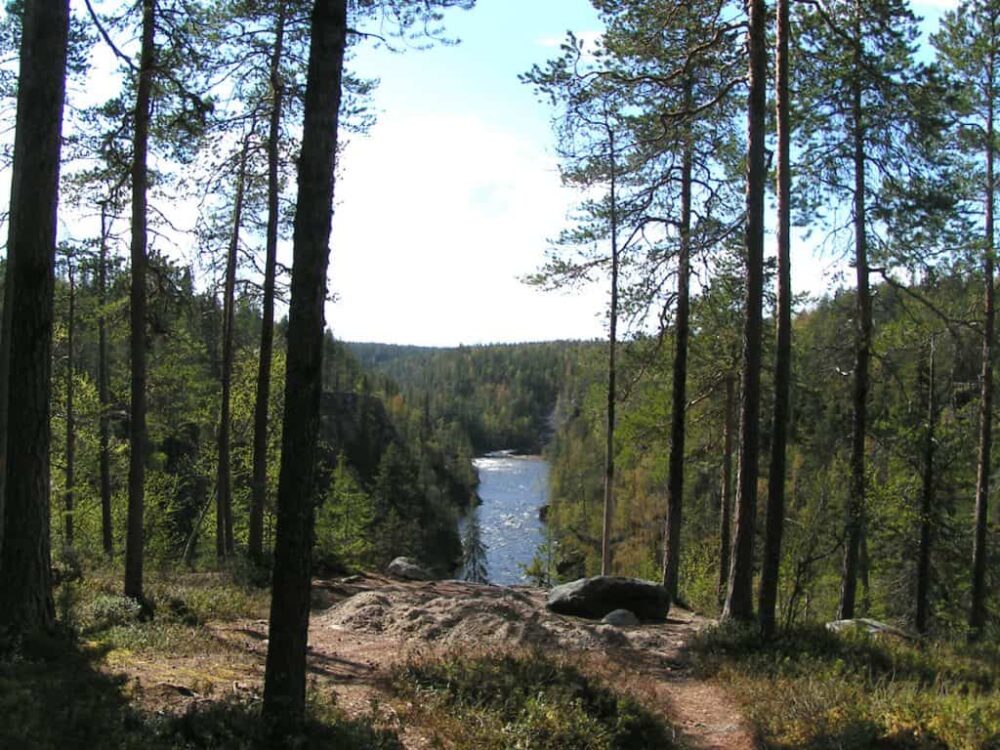
Oulanka National Park
Level: (* * *) Three bears
The Oulanka National Park has two major attractions: the great rapids of Oulankajoki and Kitkajoki, and the Karhunkierros Trail.
The Oulanka region is well-known for its beautiful nature. The first plans to protect the area were made already in the 19th century. Nevertheless, Oulanka was not among the first National Parks founded in Finland in 1938. Later in 1956, once the land ownership situation became more clear, the time was ripe for a National Park.
Before that, there was a conflict concerning the local rapids. There were plans to harness the rivers Oulankajoki and Kitkajoki for the production of electricity in the 1950’s. Fortunately, the plans were dismissed, and the rapids remained unharnessed within the National Park.
At first, the National Park consisted of the upper reaches of the Oulankajoki river and its tributary, Savinajoki, and the surrounding forests. The Park was extended in the 1980’s to Kitkajoki and Kerojärvi in north-east.
Oulankajoki has many facets. On its upper course, it runs in deep ravines surrounded by steep rocky cliffs, and the middle part has two waterfalls, Taivalköngäs and the great Kiutaköngäs. The lower course meanders slowly through sandy banks.
Kitkajoki has many rapids. After lake Juumajärvi, there’s a rapid after another, culminating to the 10-metre waterfall of Jyrävä.
The Park’s wildlife is typical of wilderness: golden eagles and sea eagles rule the sky, and the bear is the king of the forest below. More often you’ll see reindeer and elks, grouses, woodpeckers and several small birds
Humans have wandered the forests of Kuusamo and Salla since the Stone Age, and Oulanka has been a popular hunting ground to this day. Oulanka was a logging site and timber was driven down the rivers for a while in the late 19th century.
The area is also presented in this site in sections about the cultural landscapes and canoeing routes.
Hiking in Oulanka
The Oulanka National Park is a part of Finnish hiking history: The Karhunkierros Trail is the best known hiking trail in Finland. However, the Hetta – Pallas Trail is in fair competition for the title.
At the time when Finland was still part of Russia, Karhunkierros was the name of the road from Kuusamo to Paanajärvi, Tuutikylä, Käylä and back to Kuusamo church village. It was said that when this round-trip was made, at least one bear would be encircled each time.
Oulanka and Paanajärvi especially, were popular tourism destinations already back then, but Paanajärvi was later lost to the other side of eastern border. There were back-packers in Oulanka, scouts and the like, already in the 1950’s. The area had a couple of open wilderness huts, such as Taivalköngäs and Siilasmaja.
Marking of the long hiking trail, from Ristikallio via Oulankajoki and Kitkajoki rivers to the Rukatunturi fell, began in 1954. Rukatunturi too, was pristine wilderness at the time. The trail was not called Karhunkierros initially, but already in 1958, the Kuusamo hiking map had a route called Karhunkierros.
Despite its name, “Bear’s round-trip”, the Karhunkierros trail is not a round-trip trail. It runs from Rukatunturi fell to Hautajärvi Visitor Centre in Salla. There are, however, shorter round-trip trails available in the area. The Oulanka Visitor Centre is nearby the Kiutaköngäs rapids. If you’ve come to see the rapids, they are one kilometre away. If you have a bit more time, the Hiidenlampi Nature Trail turns right from the trail to Kiutaköngäs. Running anticlockwise, the trail takes you to a 5km round-trip. You can see a reindeer fence, an observation tower and a meadowland barn. At the end of the trail, you can admire the Kiutaköngäs rapids.
The Kiutaköngäs day-trip trail is an opportunity to extend your hike. The 8km trail goes a bit further to the banks of the Oulankajoki river. At the mouth of Merenoja, there’s a campfire site.
The Rytisuo Nature Trail starts from the Oulanka Camping Area next to the Visitor Centre, on the other side of the road. The themes of the 7km round-trip trail are swamp nature and meadow culture.
The crown of the day-trip trails in the National Park is the 12km long Pieni Karhunkierros, starting from the Juuma village. The route has some demanding terrain, and you should be prepared for a slower pace than on easier ground. The Jyrävä waterfall is the highlight of the route, but there are plenty of other things to see.
Oulanka in a Nutshell
Kuusamo and Salla, North Ostrobothnia and Lapland
Area: 270km2
Founded in 1956
Further info:
Book by Jouni Laaksonen: Retkeilijän kansallispuistot, Otava 2011
Driving instructions:
From Via Karelia (950), there are signs to the Juuma village and the Oulanka Visitor Centre.
Kuusamo


